
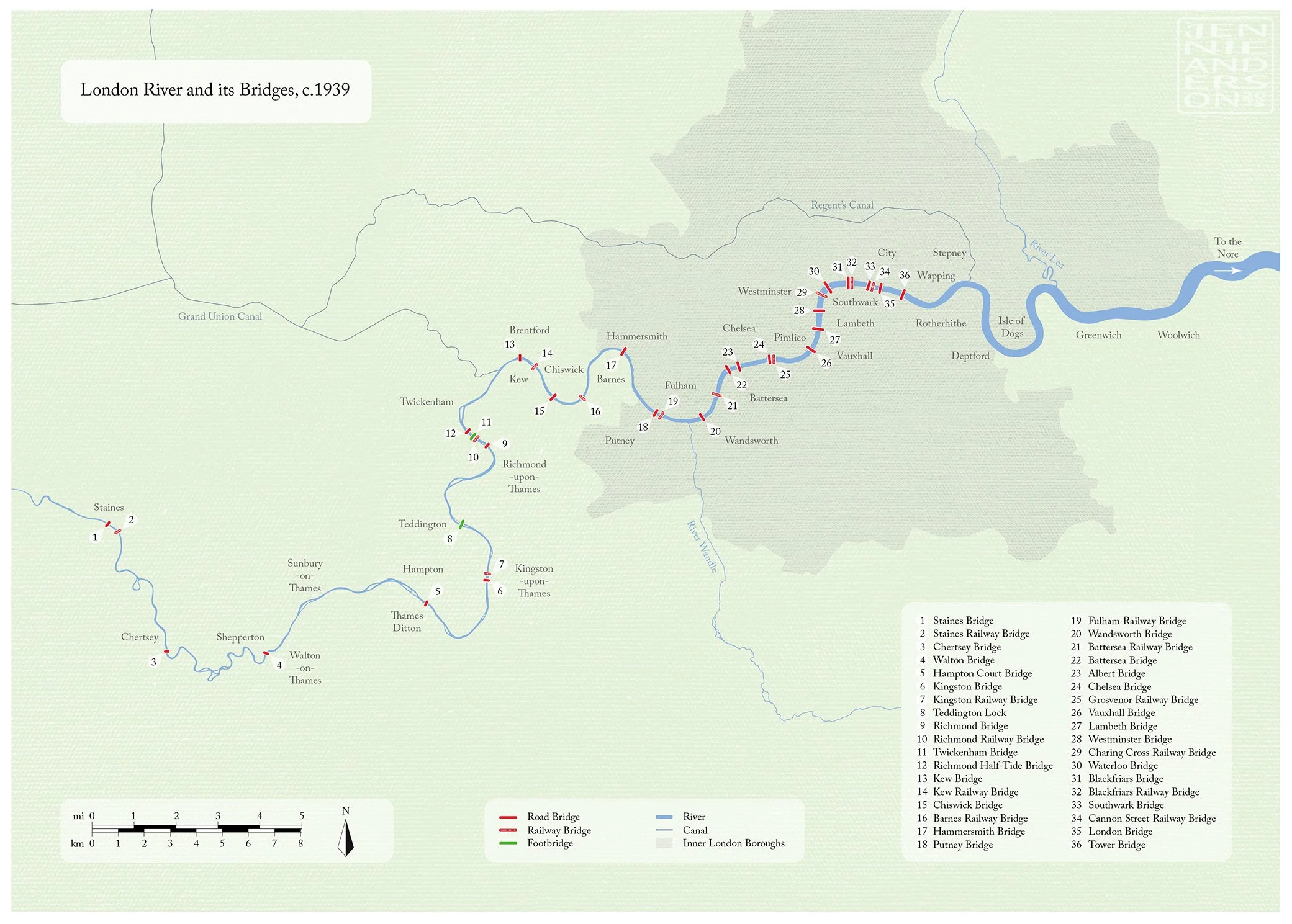
Map of the River Thames and its bridges, as of 1939. Vector illustration. Commissioned for the inner covers of the recently published 'Waterloo Bridge and London River: Investigations and Reflections' by architectural historian Andrew Saint.

Museum educational poster about medieval annular brooches. Vector, ink & watercolour illustrations.

Visitor orientation map for Oxford Castle site. Vector illustration. Commissioned by the Oxford Preservation Trust.

Educational poster: Maud de Braose and Moll Walbee. Watercolour & acrylic illustrations, digital layout.

Plan of the early mortuary structure at Wayland's Smithy 1, Oxfordshire. Vector illustration with experimental layout.

Earthwork plan of Billesley Trussell deserted medieval village, Warwickshire. Commissioned by The Churches Conservation Trust.

Vector illustration: fastening method of a medieval annular brooch 1
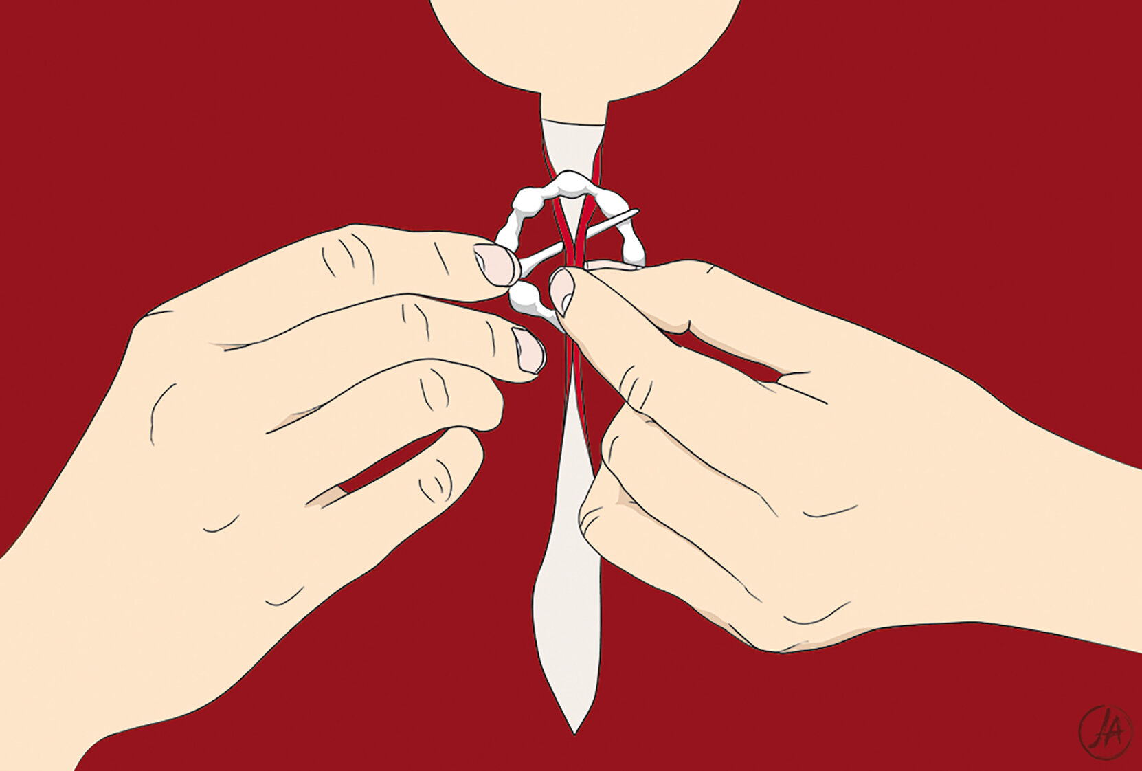
Vector illustration: fastening method of a medieval annular brooch 2

Vector illustration: fastening method of a medieval annular brooch 3
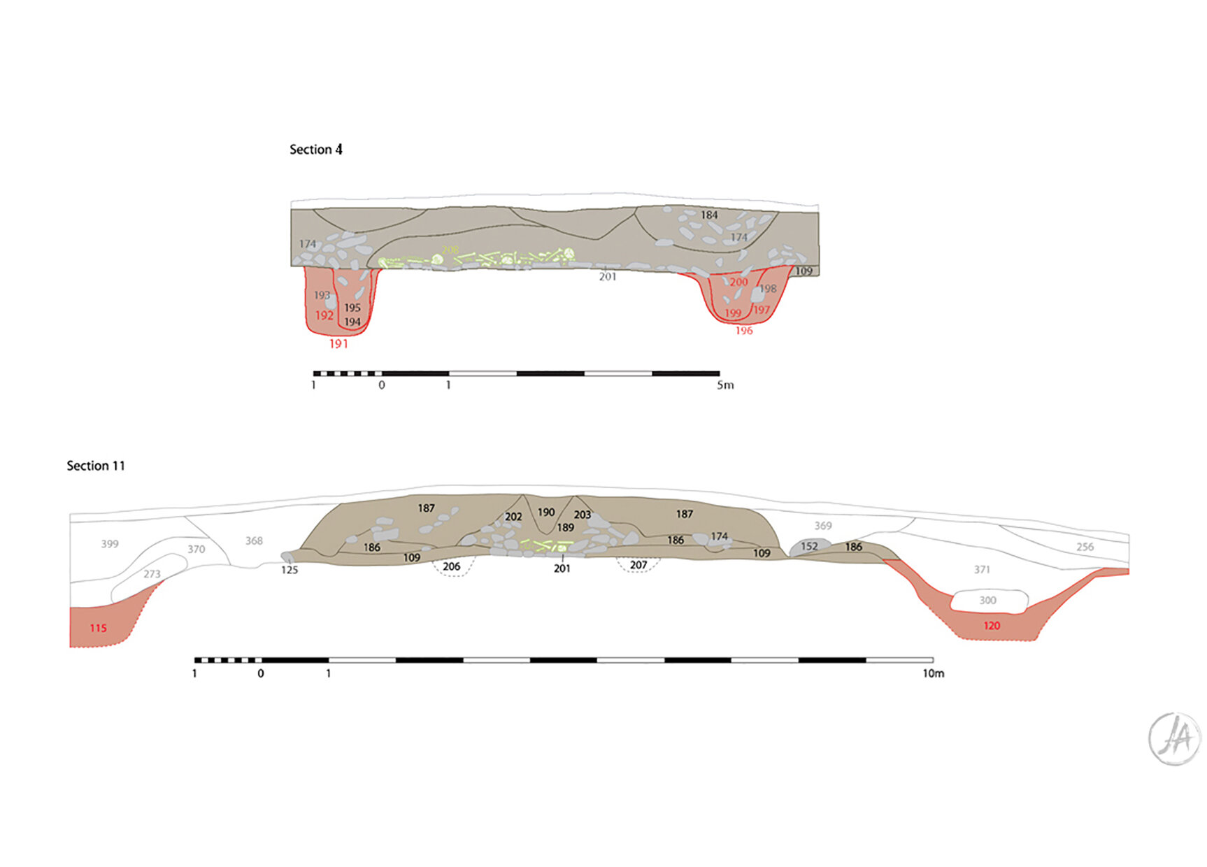
Cross-sections through the burial chamber of the early mortuary structure at Wayland's Smithy 1, Oxfordshire. Vector illustration.